Manaus hit ‘above 135’ PM2.5—schools closed as El Niño primes a long Amazon fire season
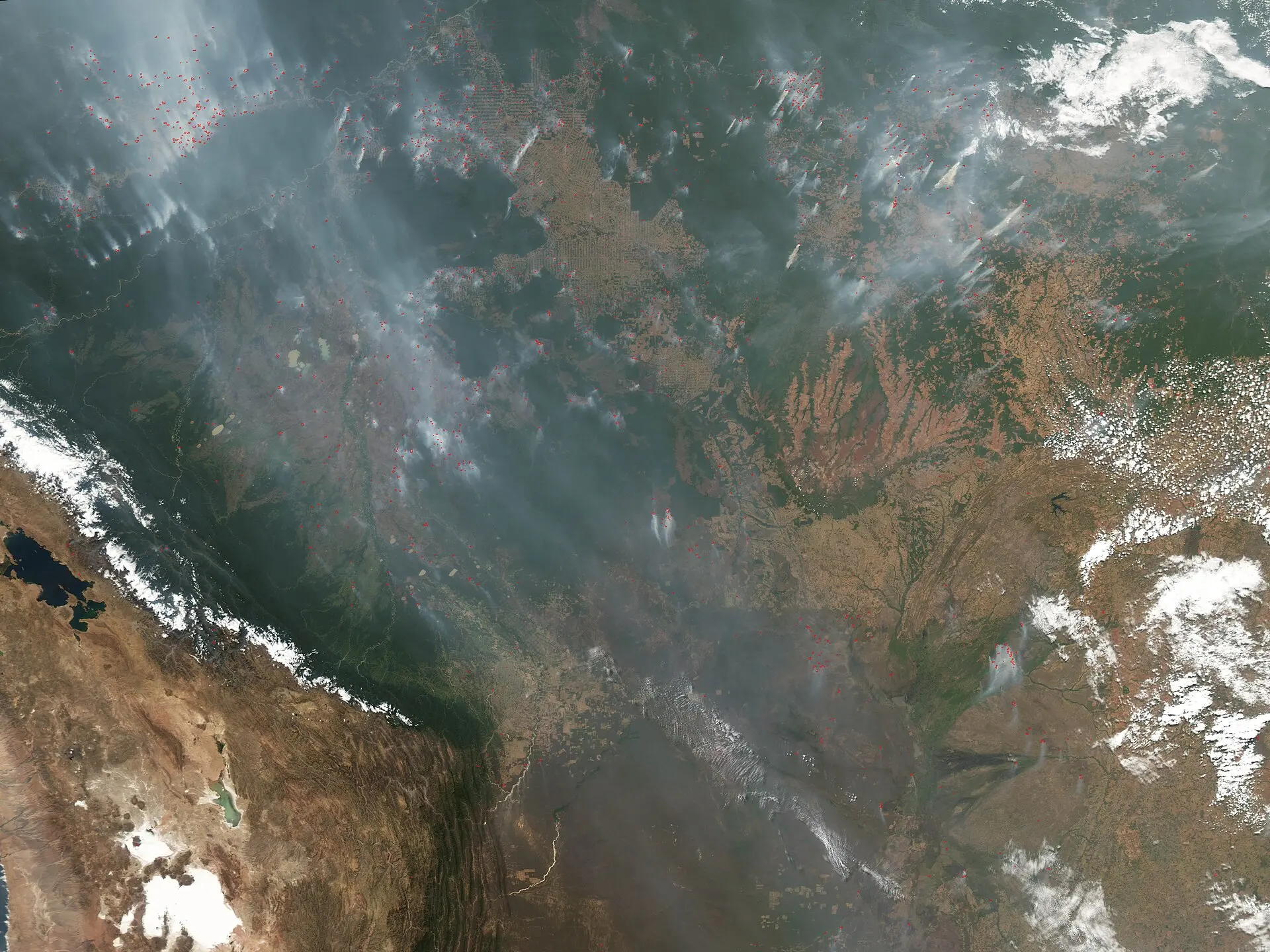
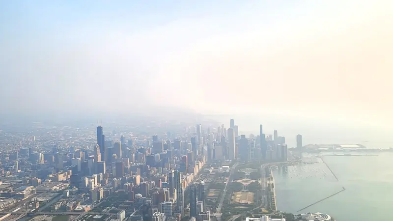
On October 12, a gray lid settled over Manaus. Schools shut. Games were canceled. City officials warned the air was unhealthy as smoke from fires on both sides of the Amazon River pooled in the basin’s biggest city. Satellites had already been flagging what people on the ground could smell: the forest was burning.
This is not a bolt‑from‑the‑blue disaster. In strong El Niño years, drought dries fuels across the tropics and fires climb a predictable ladder—from Indonesia’s peatlands toward the central and eastern Amazon. Scientists say the Amazon has now stepped onto that ladder’s higher rungs, entering the early stages of what they think will be a long, severe season.
A season primed by El Niño’s long reach
El Niño is slow violence. Rather than a storm, it’s months of parched air and missed rains. In September 2026, satellites picked up sharp increases in both fire activity and smoke emissions in the central and eastern Amazon—especially around the hubs of Manaus and Santarém. The dry spell fueling those upticks has been stark: Brazil’s National Institute of Meteorology reported Manaus rainfall 95 percent below normal in August and 60 percent below normal in September.
The pattern mirrors previous El Niño years. Drought, fire, and smoke smothered parts of Indonesia starting in August, with hundreds of homes razed in October. Researchers following the cascade expect the next wave to move farther north in November and December, and for the southern Amazon’s risk to crest late next dry season.
Not just flames—air you breathe
On the smokiest October day, Manaus officials recorded fine particulate matter—PM2.5—above 135 micrograms per cubic meter, a concentration rated the second‑worst tier on the regional air‑quality index. That number is not abstract: PM2.5 refers to particles small enough to lodge in lungs and slip into the bloodstream. Above 135 is the sort of concentration that closes schools and keeps kids off playing fields, as it did in Manaus.
The geography matters too. The central and eastern Amazon are stitched by rivers and roads that can let escaped management fires—pasture cleanup, field clearing—walk into degraded forest understory. In the Santarém region alone, analysts mapping satellite observations identified 50 to 70 uncontrolled fires.
Human sparks, not lightning
It is so wet, in a normal year, that lightning is rarely the culprit. Lightning ignites less than 1 percent of fires in the Brazilian Amazon, according to NASA scientists. That framing matters in a drought: when vegetation is primed to burn, the difference between a pile burn that stays put and one that escapes can be the difference between smoke over a single village and smoke over a city of more than 2 million.
A 2026 Environmental Research Letters study asked the pointed question—are there lightning fires in the Brazilian Amazon?—because drought shifts the odds. Its focus helps interpret this year’s numbers: the overwhelming majority of ignitions now scarring the region are linked to human activity, not storm strikes.
| Metric | Figure / Detail | Where / When | Attribution |
|---|---|---|---|
| Season status | Early stages of a likely long and severe fire season | Amazon rainforest; El Niño year | Scientists, via NASA Earth Observatory |
| Fire and smoke uptick | Sharp increases detected | Central & eastern Amazon; starting in September 2026 | Satellites, via NASA Earth Observatory |
| PM2.5 concentration | Above 135 micrograms per cubic meter | Manaus; October 12, 2026 | City officials, via NASA Earth Observatory |
| Air‑quality rating | Second‑worst tier on regional index | Manaus; October 12, 2026 | City officials, via NASA Earth Observatory |
| Uncontrolled fires | 50 to 70 | Santarém region; October 2026 | Shane Coffield, via NASA Earth Observatory |
| FIRMS undercount | About 40% more fires identified than active counts | Around Santarém; 2026 | Shane Coffield, via NASA Earth Observatory |
| Lightning-caused share | Less than 1% of fires | Brazilian Amazon; general condition | Douglas Morton, via NASA Earth Observatory |
| Rainfall deficit | 95% less than normal (Aug); 60% less (Sep) | Manaus; 2026 | Brazil’s National Institute of Meteorology, via NASA Earth Observatory |
| Indonesia impacts | Hundreds of homes razed | Indonesia; October 2026 | Douglas Morton, via NASA Earth Observatory |
| Next wave expected | Farther north in Nov–Dec 2026 | Roraima, northern Pará, Amapá; plus Venezuela, Guyana, Suriname | Douglas Morton, via NASA Earth Observatory |
| Peak risk forecast | August–September 2027 | Southern Amazon in Brazil and Paraguay | Douglas Morton, via NASA Earth Observatory |
Counting fires from space is harder than it sounds
Even in a smoky season, satellites can miss fire. Analysts mining VIIRS data found “candidate fires” that never met the threshold for official FIRMS active‑fire products. Dense smoke, cloud cover, and—crucially for the Amazon—tree canopies can screen the infrared glow of low‑intensity understory burns, so standard counts can be conservative when the very conditions that drive fires also make them harder to see.
That is why the Santarém undercount matters. In this pocket of Pará, researchers identified about 40 percent more fires than FIRMS reported. If you are trying to plan air‑quality alerts or pre‑position firefighting crews, 40 percent is the difference between a busy weekend and one that overruns your capacity.
The deeper cut
Why MODIS and VIIRS miss understory burns
Active-fire products key off thermal anomalies: if a sensor sees enough shortwave or mid-infrared radiance in a pixel, it flags a likely fire. In closed-canopy rainforest, that signal can be attenuated or masked. Lower-intensity surface fires creeping through leaf litter radiate less energy per unit area; add a multi-layer canopy and heavy aerosol optical depth from smoke, and the apparent brightness temperature drops below detection thresholds. Cloud microphysics compounds the problem—thin cirrus can still soak up or scatter enough of the emitted signal to kill the flag, even as thicker smoke columns vary spatially across the scene. That explains why analysts rail against relying on one instrument or one pass: MODIS and VIIRS have different overpass times and spectral bands, and both can be starved of signal on the smokiest days cited in the report. Mining sub-threshold “candidate fires” from the time series is essentially a signal-detection problem under occlusion: you trade false positives for recall, then hand off locations to regional mappers, like MapBiomas, for vetting against high-resolution imagery and field intelligence.
What the numbers don’t settle
Some details remain fuzzy by design or by difficulty. Officials reported PM2.5 above 135 micrograms per cubic meter but did not publish an exact number for that day; similarly, damage in Indonesia is described as “hundreds” of homes. Satellite analysts report 50 to 70 uncontrolled fires near Santarém and about 40 percent more fires than FIRMS tallies there, but which of those candidate fires will be confirmed in mapping databases is not yet specified.
Forecasts are also exactly that—forecasts. The expectation of a northward wave in November–December and a southern Amazon risk peak in August–September 2027 are forward looks tied to the current El Niño, not certainties.
What to watch next
In the near term, the obvious meter to watch is rain. Fires around Manaus and Santarém are expected to keep burning until the rainy season arrives in December 2026 or January 2027. Farther north, the anticipated wave through Roraima, northern Pará, and Amapá—along with neighboring Venezuela, Guyana, and Suriname—will test whether the cascade repeats cleanly.
Two other gauges matter. First, whether local burn bans and public messaging can cut human ignitions when drought has made escapes easier. Second, how quickly degraded forests re‑ignite: trees partially charred in recent El Niño years are more susceptible, and that legacy effect is one reason this season could bite harder than people expect.
Scale, in a single breath
It takes only one line in the table to explain why this feels different on the street: “above 135.” That is a city-scale dose of PM2.5—tiny particles that can pass from lungs into blood—high enough to cancel a school day in a capital with more than 2 million residents. To halve that daily exposure, you do not need breakthroughs in atmospheric chemistry; you need fewer escaped fires upwind while the basin waits for rain.
The paper: Are there lightning fires in the Brazilian Amazon? (Environmental Research Letters, 2026)
Related research: A pan-tropical cascade of fire driven by El Niño/Southern Oscillation (Nature Climate Change, 2017)
Sources: Fires Arrive in the Amazon Rainforest (www.nasa.gov)
Images: Cover: NASA image created by Jesse Allen, Earth Observatory, using data obtained from t / Wikimedia Commons
How this article was made: Everyman Science uses AI tools to structure, format and optimise its articles, and occasionally to produce illustrations where no free photograph exists. The reporting these articles are based on is human-produced and cited above. Spotted an error? Write to [email protected] and we will correct it. — The editors How we work.





Science desk team of Everyman Science, curating and reporting on the day’s most significant developments in research, space exploration, and technology.