The last holdfast at Thwaites
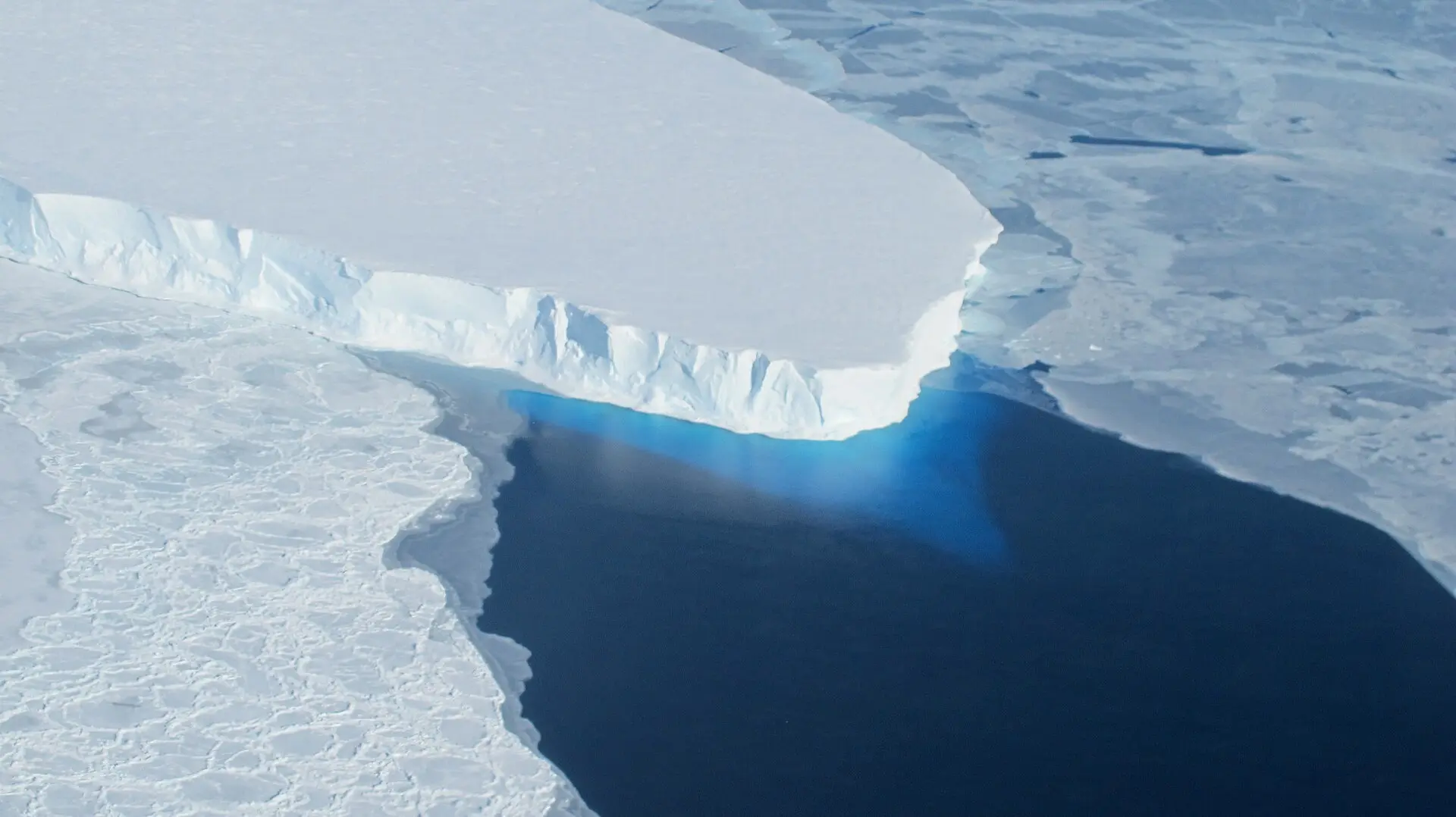
Picture a river of ice the size of a small country sliding seaward — and, for the moment, catching on a hidden bump. That bump has a name: the Mouginot Ridge. According to researchers, the main trunk of Thwaites Glacier is temporarily stabilized there, like a fingernail snagged on a splinter.
The catch may not hold. In a study published in Nature Communications, a University of California, Irvine–led team, working with NASA’s Jet Propulsion Laboratory, reports that Thwaites’ melt could raise global sea levels by up to 30 millimeters by 2100 — twice previous estimates. Their projections come from a model that matches more than two decades of observations and, crucially, abandons an old simplification about where ice stops gripping the ground and starts to float.
The line that wasn’t a line at all
Glaciologists traditionally drew a “grounding line” — a narrow boundary where grounded ice gives way to afloat ice. Lead author Mattia Poinelli says that picture is wrong for giants like Thwaites. Satellites reveal a “grounding zone,” sometimes kilometers wide, where ocean water reaches beneath the ice and the point of contact with the bed migrates back and forth.
Build the zone into the equations and the past looks different. The team reconstructed historical change from the 1990s to today that is four times more pronounced than traditional models produced. With the same physics carried forward, the model attributes up to 30 millimeters of sea-level rise to Thwaites alone by century’s end — double prior projections.
A wider, messier underside makes the glacier move
Poinelli and colleagues quantified Thwaites’ grounding zone as 4 to 6 kilometers wide. That expanse matters: more room for seawater to intrude means more of the glacier’s underbelly can lift and slip, accelerating ice flow seaward.
Crucially, the model they built is not freewheeling. The UC Irvine–led team calibrated it against over 20 years of observations, so that when it projects forward it is anchored to how Thwaites has actually behaved. That’s part of why co-author Eric Rignot points to “greater risk of and exposure to coastal flooding than anticipated in the coming decades.”
Holding on by Mouginot Ridge — for now
Even with a wide, mobile grounding zone, geography still offers brief reprieves. Poinelli notes that Thwaites’ main trunk is, for the moment, pinned on the Mouginot Ridge. As long as the glacier catches there, its retreat slows.
But the new simulations assign a 60% probability that Thwaites will unpin from that ridge by 2100. Once released, the model shows the glacier retreating more readily — a shift that helps explain why the sea-level contribution climbs so much compared with earlier work.
Why this raises the stakes for coasts
Thirty millimeters — about 1.2 inches — is not a doomsday number by itself. But it stacks on top of every other driver of rising seas and storm surge that communities already contend with. Rignot’s warning is plain: larger projections from Thwaites mean more people and infrastructure will be exposed to flooding sooner than planners expected.
Because the new model’s results are twice previous estimates, coastal risk assessments that relied on older Antarctic numbers will understate the hazard. Updating them isn’t an academic exercise; it’s the difference between a seawall that overtops and one that doesn’t.
What’s still uncertain — and what isn’t
No model gives a single inevitable future. Here, the unpinning of Mouginot Ridge carries a 60% probability — not a guarantee — and the precise pace of retreat through the grounding zone depends on how the system evolves. Different modeling choices in the past yielded slower changes; that mismatch with observations is exactly what the new approach set out to fix by calibrating against more than 20 years of data.
What is firm is the direction of travel. Accounting for a kilometers-wide grounding zone produces a substantially larger and earlier contribution to sea level than treating it as a narrow line, and the study’s upper-end figure is up to 30 millimeters by 2100.
The deeper cut
Grounding line vs. grounding zone, in the math
In many ice-sheet models, the grounding line is a moving boundary where basal traction switches from finite (grounded) to near-zero (floating). Numerically, that creates a stiff, ill-posed transition unless mesh or parameterizations are tuned to track a narrow interface. The Thwaites work relaxes that idealization by admitting a grounding zone 4–6 km wide in which effective pressure, basal drag, and melt vary continuously in space and time. Tides and sub-ice-shelf circulation modulate the contact state within that band, so the hydrology and stress balance produce transient lift-off over kilometer scales rather than at a single curve.
Why does this amplify retreat and flow? Two reasons. First, reducing basal drag over a broad zone increases driving- to resisting-stress ratios, so flux across the grounding region scales up nonlinearly with the area experiencing partial or full flotation. Second, allowing the nominal grounding “front” to wander within the zone increases sensitivity to modest perturbations: once unpinning initiates on a stabilizing ridge, a larger fraction of the trunk experiences low effective pressure, hastening detachment. Calibrating this parameter space to more than 20 years of observed behavior constrains the melt–drag combinations that reproduce the past, and those same combinations yield a doubling of projected sea-level contribution by 2100 relative to models that enforce a thin grounding line.
A sharper tool, not a final word
The team emphasizes process, not bravado. By swapping a line for a zone and tuning the model to observed history, they closed a long-standing gap between measurements and simulations of Thwaites’ rapid changes, yielding historical shifts four times more pronounced than traditional models and future sea-level contribution up to 30 millimeters by 2100.
That does not settle every debate about Antarctica. It does set a new baseline: if you care about sea-level risk this century, a wider, slippier underside at Thwaites now belongs in the calculation — and the Mouginot Ridge cannot be counted on to hold.
How planners might use this now
For city engineers and insurers, the headline change is simple: the Antarctic input they plug into coastal-flood models is larger. The study’s finding that Thwaites’ contribution is twice previous estimates and could reach up to 30 millimeters by 2100 implies greater exposure to flooding along many coasts, sooner.
That makes room for sensible adjustments — from reassessing design heights to moving critical systems out of harm’s way — guided by projections aligned with two decades of observed change, and by the sober possibility that the Mouginot Ridge’s hold may not last.
The paper: Sea-level contribution from Thwaites Glacier doubles in an observation-constrained ice-sheet model (Nature Communications, 2026)
Sources: Thwaites Glacier could contribute twice as much sea-level rise as previously projected (phys.org)
Images: Cover: NASA / Wikimedia Commons; Figure 1: MODIS Land Rapid Response Team, NASA GSFC / Wikimedia Commons; Figure 2: Judgefloro / Wikimedia Commons
How this article was made: Everyman Science uses AI tools to structure, format and optimise its articles, and occasionally to produce illustrations where no free photograph exists. The reporting these articles are based on is human-produced and cited above. Spotted an error? Write to [email protected] and we will correct it. — The editors How we work.





Science desk team of Everyman Science, curating and reporting on the day’s most significant developments in research, space exploration, and technology.