El Niño, explained: how a warm Pacific shakes rain belts, food prices and fire seasons
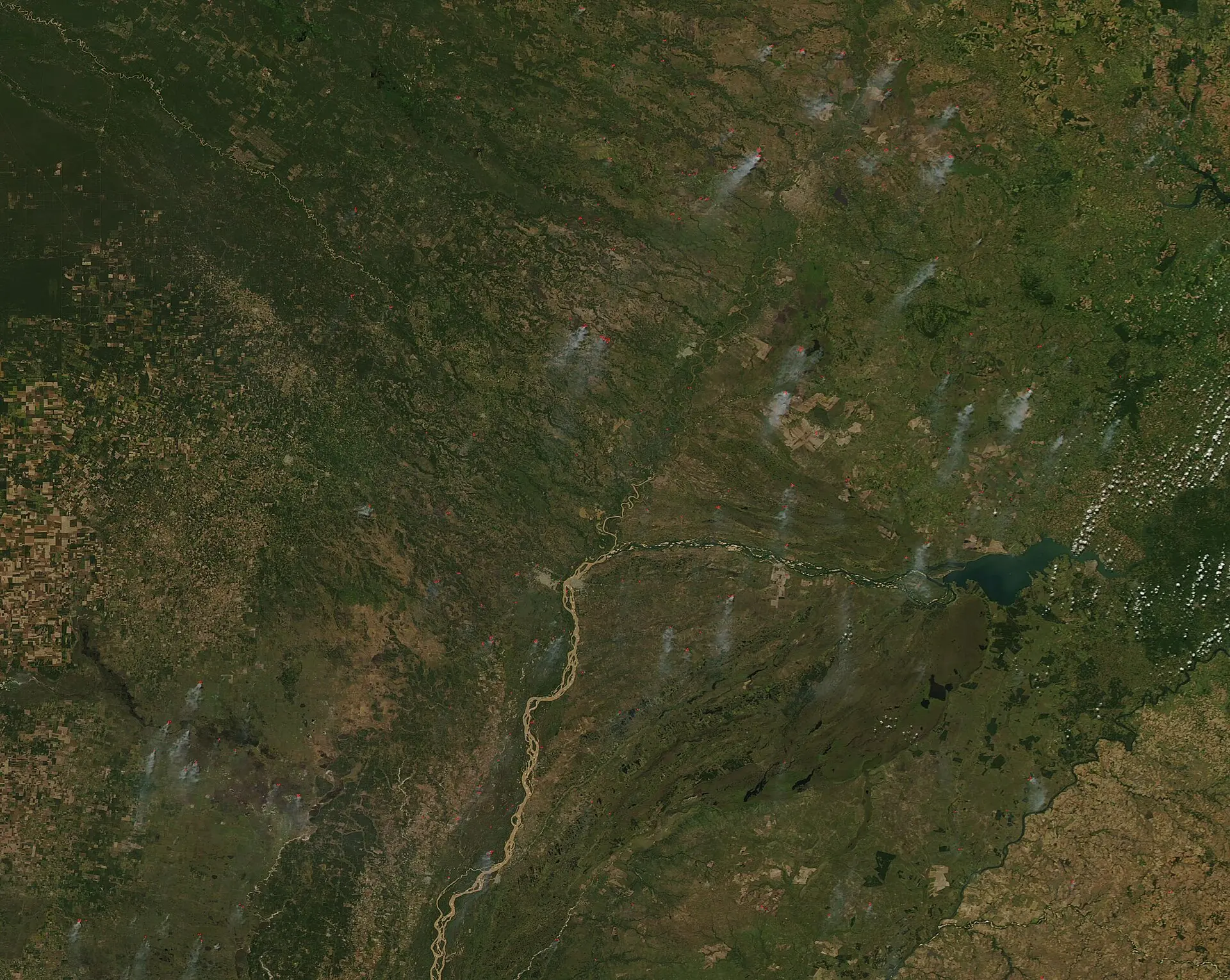
In Thailand’s paddies, diesel pumps growl through what should be an easy stretch of the wet season. Farmers hedge against skies that don’t keep their promises, as fires chew across farmland elsewhere in Southeast Asia. Experts say the El Niño now building is expected to drive new extremes of drought, heat waves, flooding and other disruptions, with a real human bottom line: food on plates and prices on shelves.
That is why you’re hearing about it now. This El Niño is forecast to peak in December, and U.S. forecasters put the odds at 69% that it will be the strongest recorded since 1950. The United Nations’ World Food Program warns it could push at least 49 million more people into acute food insecurity by the end of 2027. Analysts at Goldman Sachs estimate global food commodity prices could rise more than 15% if it unfolds the way models suggest.
Start here: a giant, wind‑driven see‑saw
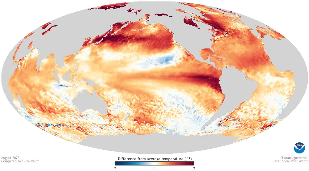
Imagine the equatorial Pacific as a very wide, shallow bathtub. In “normal” years, steady trade winds blow west, piling warm surface water toward Indonesia and Australia and letting cooler, nutrient‑rich water rise near South America. In El Niño years, those trades weaken. The warm pool sloshes back east, the cool upwelling fades, and the eastern and central Pacific warm.
The bathtub image is helpful because it captures the slosh. Where it breaks down is biology and atmosphere: the ocean is not just water waiting to settle. As the surface warms, tropical thunderstorm patterns and high‑altitude winds shift, and those shifts in turn push on the ocean again. El Niño is a coupled ocean–atmosphere event, not merely a warm patch drifting aimlessly.
How a warmer Pacific moves rain belts
Tropical rainfall tracks warm water like iron filings track a magnet. When the central and eastern Pacific heat up, the band of rising, storm‑making air over the equator shifts east too. Regions that usually sit under persistent uplift can be left high and dry; regions that usually sit under descending air can suddenly get deluged.
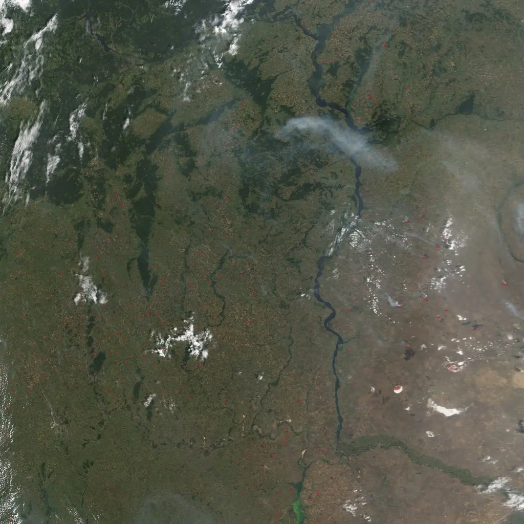
Southeast Asia’s wet season generally runs from June to October, recharging reservoirs and priming soils for the next planting. Under El Niño, that seasonal reliability wobbles. Less reliable rains and hotter air dry out vegetation, helping fires spread across farmland, and pressure city water supplies.
From physics to the pantry: why rice, palm oil and prices move
When the rains stumble, farmers delay planting, reduce acreage, or switch crops. That matters beyond the region because the world’s top three exporters of rice—India, Vietnam and Thailand—are among those most likely to be hit hard this year. Shortfalls and export curbs in these staples can ripple quickly through global markets.
Past El Niño events have racked up losses worth trillions of dollars, and this one comes with forecasts of more than a 15% jump in global food commodity prices. The World Food Program’s projection—tens of millions pushed into acute food insecurity—connects those market moves to household kitchens in a sobering way.
How forecasters see it coming
El Niño is predictable months ahead because the equatorial ocean changes slowly and because winds and surface temperatures feed back on each other. Models start from observed sea temperatures and winds, then let physics evolve them forward in time. Multiple model runs—ensembles—map the plausible paths, from weak to strong events.
Two ingredients give confidence right now: the ocean has already warmed across key swaths of the Pacific, and the atmosphere is behaving as if it “notices” that warmth. That alignment is why experts warn of new extremes, and why governments from farm ministries to treasuries are gaming out drought, flood and price scenarios.
When it breaks: fires, fisheries and timing
Dry spells in the wet season don’t just cut yields; they push forests and peatlands toward ignition and make fire control harder. Fisheries suffer when cooler, nutrient‑rich upwelling weakens, and when river levels drop, as communities along major basins discover their calendars for planting and netting no longer match the water.
On land, the mismatch shows up as hard choices: pump more, plant later, or plant less. At sea, it shows up as smaller catches and costlier fuel. The damages compound into prices, poverty and migration—why regional shocks in Southeast Asia can push on wallets worldwide.
The deeper cut
Inside the loop: Bjerknes feedback and equatorial waves
At the heart of El Niño is a positive feedback between zonal wind stress (τ), sea surface temperature (SST) and the thermocline tilt. In neutral conditions, easterly trades maintain a west‑warm/east‑cool SST gradient and a west‑deep/east‑shallow thermocline. A westerly wind anomaly (weaker trades) reduces upwelling and shoaling in the east, warming SST there. Warmer eastern SST weakens the east–west SST gradient, further relaxing the trades: that is the Bjerknes feedback. Mathematically, ∂(SST′)/∂t depends on anomalous upwelling (w′), horizontal advection by currents (u′·∇SST), and surface fluxes; τ anomalies modulate both w′ and u′ through Ekman divergence and Kelvin/Rossby wave dynamics.
Equatorial Kelvin waves rapidly transmit subsurface heat content eastward along the thermocline, deepening it in the east and preconditioning surface warming; reflected Rossby waves return anomalies westward off the equator, closing the basin‑scale adjustment. The seasonality of growth hinges on background mean state and damping (cloud‑radiative feedbacks, latent heat fluxes). Forecast “barriers” arise when springtime noise in winds projects efficiently onto these wave modes, decorrelating initial‑condition skill. Strong events typically exhibit large warm‑water volume anomalies preceding peak, a flattened thermocline, and robust coupling indices (e.g., high covariance between τ and SST′ in the central Pacific).
What we don’t know yet
Forecasts can say “strong and likely to peak in December,” but not precisely which districts will be 30% drier or which week planting should start. Local rainfall depends on storm tracks and topography that global models smooth over. Agriculture, in turn, depends on decisions—planting dates, irrigation rules, trade policies—that models don’t set.
Prices and poverty headcounts are likewise uncertain because they hinge on policy responses and logistics. One government’s export ban can matter as much as the weather; another’s reserve release can cushion a spike. The physics is firm; the lived outcome is still open.
What response looks like on the ground
Governments are already moving. Malaysia’s prime minister has ordered the Ministry of Agriculture and Food Security to find ways to blunt El Niño’s impact, as the event is forecast to hit the country hardest around November. Elsewhere in the region, the same playbook appears: secure water, support farmers, and brace food systems for a rough season.
For households far from the Pacific, the connection is simple but easy to miss: when a warm ocean shifts where and when it rains, harvests change, and so do prices. An ocean‑atmosphere loop that starts with weakened trade winds can end with the grocery bill.
Sources: Worsening El Nino threatens Asia with drought, potentially raising food prices globally (phys.org)
Images: Cover: MODIS Land Rapid Response Team, NASA GSFC / Wikimedia Commons; Figure 1: NOAA / Wikimedia Commons; Figure 2: NASA image by Jesse Allen, based on data from the MODIS Rapid Response Team, NAS / Wikimedia Commons
How this article was made: Everyman Science uses AI tools to structure, format and optimise its articles, and occasionally to produce illustrations where no free photograph exists. The reporting these articles are based on is human-produced and cited above. Spotted an error? Write to [email protected] and we will correct it. — The editors How we work.





Science desk team of Everyman Science, curating and reporting on the day’s most significant developments in research, space exploration, and technology.